Emergency management officials understand that communication issues often arise during events and will be addressed in after-action reviews. Responding to Mitchell County, North Carolina, as part of the Texas Division of Emergency Management’s (TDEM) Incident Support Task Force, I experienced firsthand what it is like to respond to a disaster when all ground-based forms of communication are offline.
Communicating in the Field
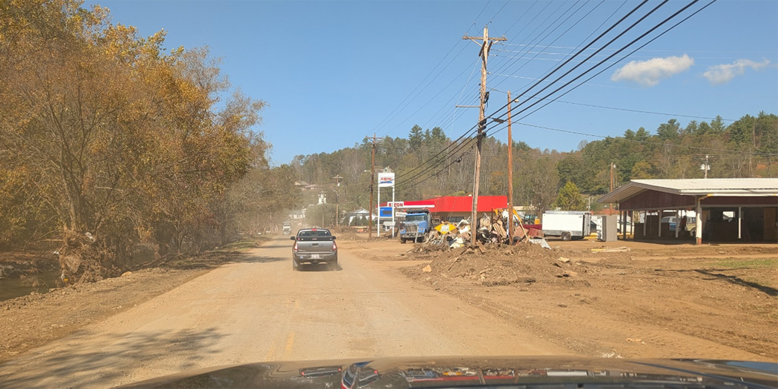
Before entering the area affected by Hurricane Helene in September 2024, the team leader advised that all Federal Emergency Management Agency (FEMA) Community Lifelines were impacted. Being unfamiliar with the area in which my team would soon spend two weeks, an immediate concern to mitigate was navigating without the cell phones the team relies on daily. The solution came from an often-overlooked feature in Google Maps—the ability to download maps for offline use. Before leaving the staging area, team members downloaded the map of Western North Carolina. When we entered the affected area and lost cell signal, the phones continued to work using the downloaded data and satellite GPS. Many team members commented that this offline usage of Google Maps was crucial in their response.
When I arrived in Mitchell County, I met with a Type 1 Incident Management Team (IMT) from Louisiana. In the initial briefing, the IMT immediately listed communications as a challenge. The primary issue was how to distribute a daily incident action plan (IAP) to hundreds of responders dispersed over hundreds of miles in remote areas without easy access to email. The IMT solved the issue by creating a QR code to access a web page with the IAP. Responders could find this QR code throughout the county, taped to base camps, government buildings, churches, stores, distribution sites, and other locations with Wi-Fi. Responders could then download the IAP to their phones for offline use. To distribute the IAP daily, the emergency operations center only needed to update the web page accessed by the QR code.
When Wi-Fi was available, it was through terminals linked to satellite-based internet. Various organizations had donated hundreds of such devices to the region. Seemingly organically, they found their way to fire stations, points-of-distribution (POD) sites, and other community centers. Paradoxically, this futuristic satellite technology made fieldwork seem like it had gone backward. To place a call, someone would travel to the nearest terminal as if it were a 100-year-old police call box. The locations of these terminals were not conveyed to responders, but it would be helpful to add them to future IAPs. Additionally, calls could only be made to people working in a location with a satellite terminal. While it may sound inconvenient, it still saved responders a drive across the county to communicate a need.
Communicating with the Public
The most challenging audience to communicate with was the public. The county implemented multiple strategies toward this goal. One was to hold two town hall–style meetings a day, which were led by the county administrator. The small-town environment of Bakersville and Spruce Pine was conducive to these meetings. The county administrator would go table by table, addressing representatives from various organizations by first name and asking them to provide a public update. For people who could not attend the town hall meetings, the county partnered with the local AM radio station (1470 WTOE), which would attend the town hall meetings and provide summaries to the community multiple times a day. In addition to these meetings, the county printed a newsletter, provided copies to POD sites, and hung them at public message boards throughout the county.
Implementing Lessons Learned
One of the most beneficial aspects of participating in TDEM’s Incident Support Task Force is implementing lessons from other disasters into future office plans. Recommendations that stem from these lessons learned include the following key action items.
- Coordinate with the IT department to implement a backup Starlink or other satellite communication system for the organization’s buildings.
- Coordinate with the public information officer and senior leadership to create a plan for distributing information to the public that does not require internet services. Include outside resources like radio or TV broadcasters in the area.
- Create a system to utilize a cloud-based server that a QR code can access so people can download daily IAPs. Incorporate maps showing response organizations’ locations where they can access data into IAPs.
- For daily operations, download area maps near home and work to relevant devices for offline use.
- When responding outside the regular area, add “download maps” to the response checklist.
Mitchell County and TDEM provided a valuable opportunity to participate in and learn from this response. The lessons discussed here can help teams nationwide take steps to ease their future response and recovery efforts.

Jarod Rosson
Jarod Rosson holds a bachelor’s degree in Texas history from McMurry University. He began public service as a deputy sheriff in 2013 and holds a Master Peace Officer Proficiency Certification from the Texas Commission on Law Enforcement. After participating in the Wimberley Memorial Day Floods response, he decided to change career paths to emergency management. He earned a master’s in public administration from the University of North Texas during this transition. After receiving his degree, he was hired as the deputy emergency management coordinator for Rockwall County and subsequently promoted to coordinator.
- Jarod Rossonhttps://www.domprep.com/author/jarod-rosson